Geospatial system with PostGIS
OpenStreetMap + PostGIS = ❤️
More information
This was my first foray into using geospatial data, rendering and interacting with my own maps. Thankfully, open data like the kind provided by OpenStreetMap made for a pleasant experience.
What I did
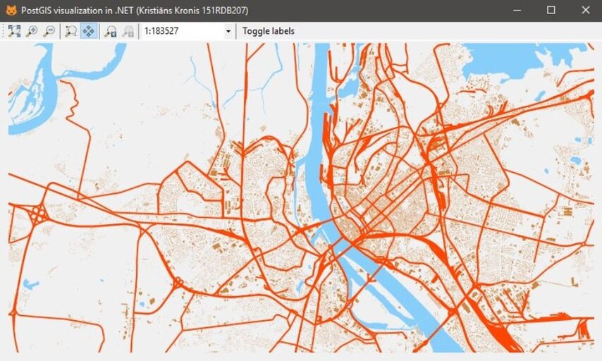
I ended up both importing the data for my entire country into a PostGIS database, modifying and interacting with it inside of QGIS, as well as eventually creating a desktop application with C#, which let me visualize it and move around freely. Not only was this free, but the setup was lightweight enough to run the database itself on an affordable VPS, should the need arise.
What I learnt
While nowadays I'd focus on using something like Leaflet.js, this was a perfectly passable introduction into working with geospatial data and a good starting point overall. After all, there is definitely a benefit to then moving on to running your own tile or vector server, so that you don't have to rely on external providers, both because of privacy concerns, as well as the fact that you'd otherwise create a lot of load on their services.